Image
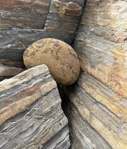
Photo credit: Weston Beach Abstraction, ©Ernie Long
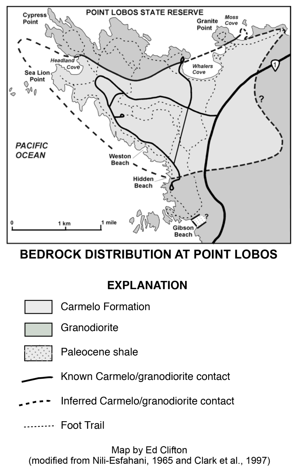
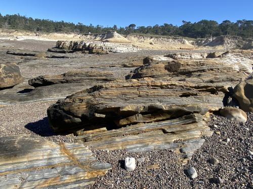
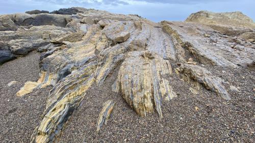
Two very different kinds of bedrock compose the foundation of Point Lobos State Reserve. The older is granodiorite, a granite-like crystalline rock that underlies the entire Monterey Peninsula region. A younger sedimentary rock (the Carmelo Formation), consisting of solidified layers of sand, gravel and mud, sits on top of the granodiorite.
Where did these rocks originate and how did they get here?
Both the granodiorite and the Carmelo Formation originated far south of their present location, probably somewhere in what is now Southern California, or even northern Mexico. Today, most geologists think the granodiorite crystallized in a southern extension of the mass of crystalline rock known as the Sierra Nevada batholith.
Some 20-30 million years ago, a great oceanic crustal plate (Pacific Plate) encountered the North American Plate and began sliding past it toward the northwest. The motion occurred along giant fractures such as the San Andreas Fault, which lies about 40 miles northeast of Point Lobos. A large slab of the continental crust in southern California, which geologists call the Salinia block, became detached from the rest of the continent and slid to the northwest. The rocks now exposed at Point Lobos moved as part of this block.
The forces involved in the transport of the block caused these rocks to buckle and break (some, perhaps much, of the deformation of the Carmelo Formation may have resulted earlier from large submarine landslides within the ancient submarine canyon).
As the rocks approached their present geographic location, they also moved upward. Within the past half-million years, they reached sea level and became subject to the attack of ocean waves. The sand and pebbles released from the rocks by this erosion constitute the beaches that we walk on at the Reserve today.
About 80 million years ago, while dinosaurs still roamed the earth, a mass of molten rock (magma) cooled and crystallized 5 to 10 miles beneath the surface of the earth, at temperatures approaching 1000° F (550° C) and pressures of 30-40 tons per square inch (450-500 kg/m2). As the rock became solid, further cooling caused it to crack. Mineral-rich superheated water pushed into the fractures, where dissolved minerals crystallized. Today, these filled cracks are visible as light-colored sheets (called veins or dikes) a half- inch to many inches thick that cut across the rock.
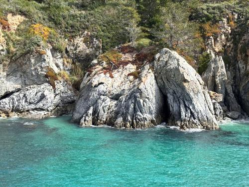
Minerals in the granodiorite include the feldspar minerals orthoclase and plagioclase, quartz, small scaly flakes of dark mica (biotite), and little masses of shiny greenish-black hornblende. The orthoclase crystals are particularly large and show a striking parallel alignment. On sunny days, sunlight reflects from perfect fracture planes within the orthoclase crystals.
The granodiorite is exposed in the walls of the parking lot at Whalers Cove (where it was quarried for building stone in the 1850s), on Granite Point, in the narrow steep-walled coves, such as China Cove, visible from the North Shore and Cypress Grove Trails, and along the coast south of Hidden Beach.
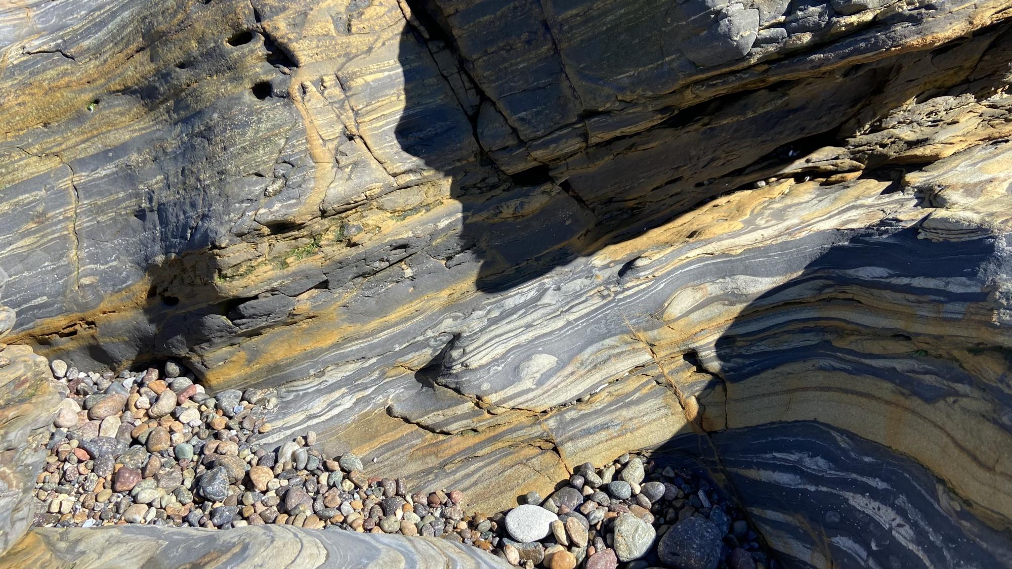
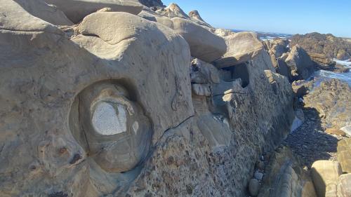
At Point Lobos, an ancient deposit of gravel, sand and mud filled a large valley cut into the granodiorite. This layered sediment, which subsequently became cemented into rock called the Carmelo Formation, contrasts sharply with the light gray, massive crystalline rock.
The few fossils found in the rock place its age in the lower Paleogene Period, 50-60 million years ago, and indicate that it accumulated on the sea floor at depths of 200-600 meters (about 600-2,000 feet).
The combination of the valley-fill shape of the unit and the indicated depth of accumulation suggests that it formed in an ancient submarine canyon. Examples of submarine canyon deposits are very rare, and geologists come from all parts of the world to study the sedimentary rocks at Point Lobos.
The Carmelo Formation can be examined in Moss Cove, The Pit, Sea Lion Point, and along the South Shore Trail.
The Carmelo Formation consists mostly of the pebbly rock conglomerate and sandstone, with lesser amounts of mudstone. Pebbles in the conglomerate are predominantly well-rounded fragments of resistant volcanic rock.
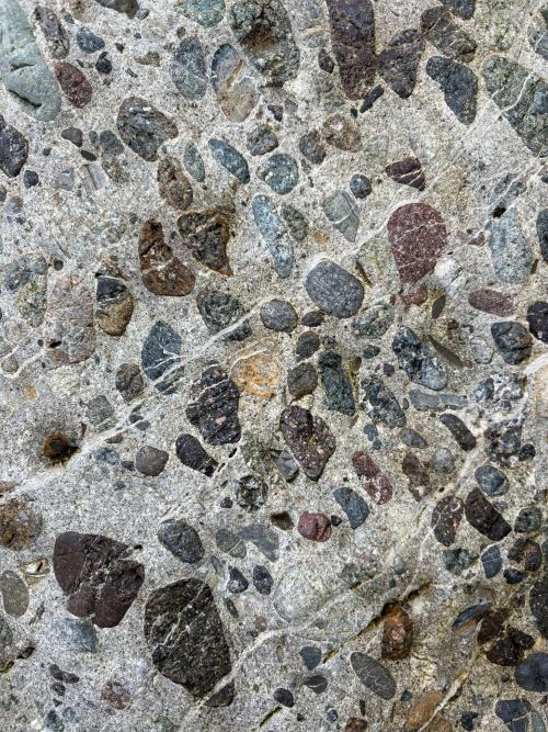
The composition of some pebbles suggests a source in Jurassic volcanic rock in the Mojave Desert area.
Submarine landslides and turbidity currents (avalanches of turbid mixtures of sand, mud, gravel and water) cascaded into the ocean depths and deposited sand and gravel on the floor of the canyon. In most of the sandstone beds, the coarsest grains occur near the bed bottom, a characteristic of deep-water sands deposited by turbidity currents. Dark muddy intervals in the Carmelo Formation accumulated at times or places of limited sand and/or gravel delivery.
At Gibson Beach, granodiorite is thrust over shale that contains Paleocene epoch fossils considered to be 55-65 million years old. The relationship of this shale to the rest of the Carmelo Formation is uncertain. Microfossils collected from the Carmelo Formation at Hidden Beach suggest a later age (early Eocene epoch, 50-55 million years ago).
Although the sedimentary rock here contains very few fossil shells, a host of animals lived on or beneath the seafloor.
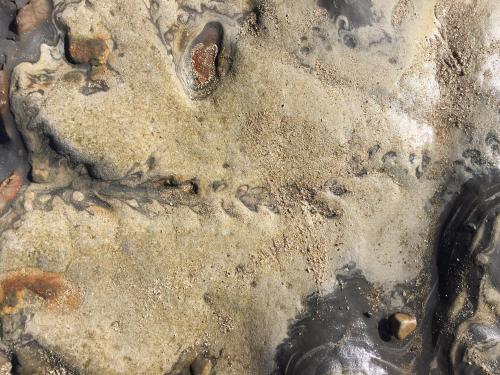
Muddy and sandy deposits bear evidence of the existence of these organisms in the form of trace fossils – patterns in the sediment produced by bottom dwellers as part of their living and feeding activities.
Many traces originally were simple, open tubes through the sediment that became filled with sand and mud after they were vacated; others were highly complex.
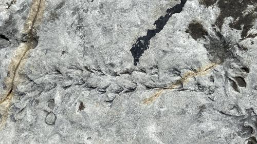
The feeding pattern of one organism was initially thought to represent fossil seaweed because its shape so closely resembles that of kelp strands that wash onto beaches here today. Burrowing worms and shrimp-like creatures are probably responsible for many of the traces. Some geologists think that a clam created the kelp-like trace as it fed through the sediment.
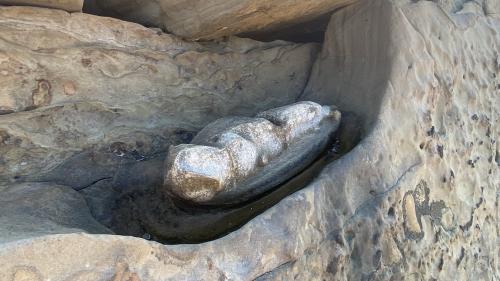
Strange circular patterns mark the exposed tops of many sandstone beds along the South Shore Trail. Called concretions by geologists, these features form during the transformation of loose sand into rock called sandstone.
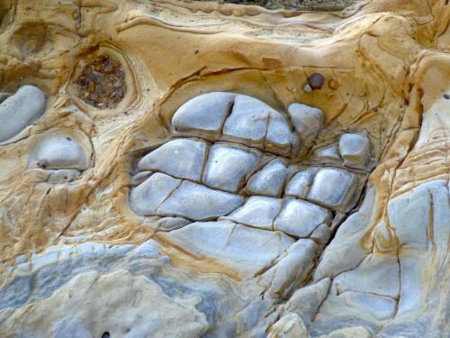
For obscure reasons, some locations in the sand become sites of early mineral cementation, forming a round, hard lump in the otherwise unconsolidated sand. As sediment continues to accumulate, the increasing weight forces the rest of the sand grains to interlock, and the loose sand becomes sandstone. The resistance to subsequent weathering and erosion of the rock thus formed may differ from that of the concretionary lumps.
These concentrated deposits may form either spherical bumps or circular depressions on the sandstone.
Concretions grow in concentric rings (almost like an onion) and the different rings can commonly be seen on the sandstone surface where the concretions are weathering out.